Download Center
Access our collection of geospatial data in Shapefile format for analysis and visualization.
GEODATA OF PROTECTED WILD AREAS OF COCOS MARINE CONSERVATION AREA

Protected Wild Areas of ACMC 1978-2021
Layer showing the different expansions of Cocos Island National Park and the Bicentennial Management Marine Area
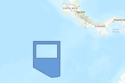
Bicentennial Management Marine Area 2021
Polygon of the Bicentennial Management Marine Area (2021)
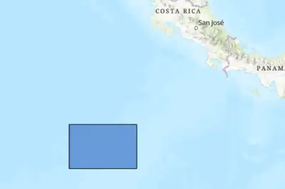
Cocos Island National Park
Polygon of Cocos Island National Park (2021)

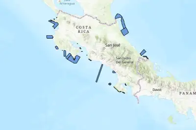
Cocos Island National Park 1978-2021
This layer shows the evolution of Cocos Island National Park from 1978 to 2021, providing a temporal analysis of its extension and changes in the protected area
Zoning of Cocos Island National Park (2024)
This layer shows the updated zoning of Cocos Island National Park (PNIC) for 2024, highlighting the different areas of use and conservation within the park
Marine Protected Areas of Costa Rica
Layer showing the Marine Protected Areas of Costa Rica
GEODATA OF COCOS ISLAND
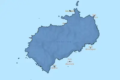
Cocos Island Polygon
This layer delimits the polygon representing Cocos Island, including its precise geographic outline
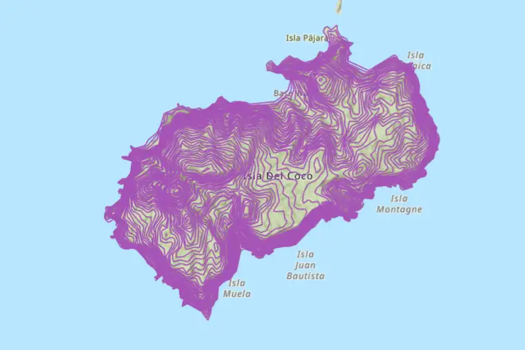
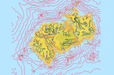
Contour Lines (1:50,000)
The layer contains contour lines generated from a digital terrain model (DTM) at 1:50,000 scale. The contour lines are drawn at 10-meter intervals
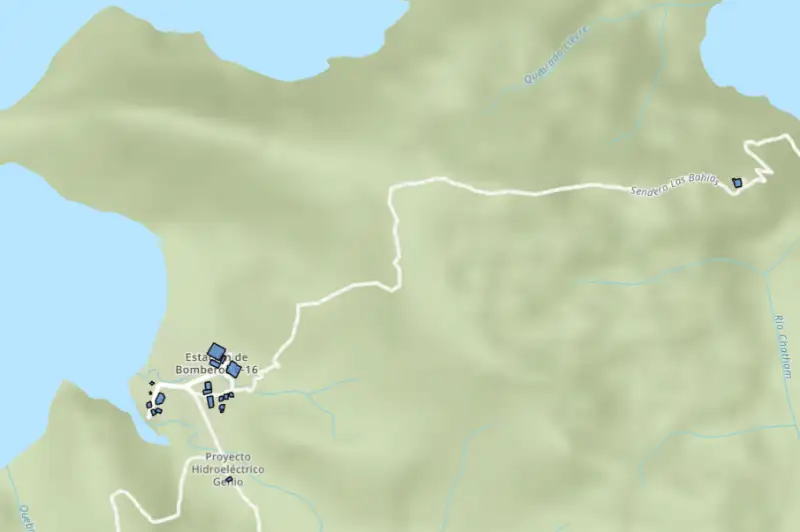
Cocos Island Infrastructure (2024)
The layer represents the infrastructure of Cocos Island, created from an aerial image captured in 2023 and updated with information collected until 2024
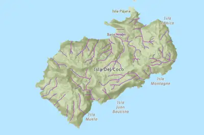
Hydrographic Network of Cocos Island (2023)
This layer is an updated version of the hydrographic network of Cocos Island, with accurate information extracted from a 2023 aerial image in Wafer Bay and Chatham Bay
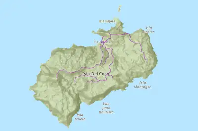
Cocos Island Trails (2024)
The layer shows the trails within Cocos Island, including the Doña Dulce trail (version 1), updated to August 2024. The Wafer Bay and Chatham Bay trails are corrected based on an aerial image taken in December 2023.
Cocos Island Trails
The shapefile layer shows the trails within Cocos Island, including access routes to areas of ecological, tourist and scientific interest
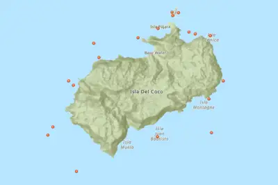
Recreational Diving Sites
This layer identifies recreational diving sites on Cocos Island, highlighting the most frequently visited areas of interest to tourists and researchers
Acceptable Carrying Capacity for Diving Sites
Layer showing the acceptable carrying capacity for diving sites at Cocos Island National Park
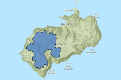
Cloud Forest Distribution
This layer shows the distribution of cloud forest, delimited by areas that exceed 300 meters above sea level, using contour lines at 1:50,000 scale
Anchoring Sites
The layer shows anchoring sites located in Wafer Bay, Chatham Bay and Yglesias Bay, indicating zones where vessels must anchor to avoid minimal impact on the marine substrate
.webp)
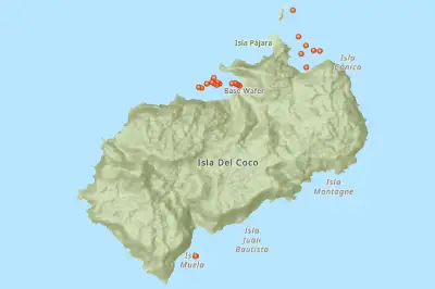
Research and Monitoring Sites (plots)
This layer indicates specific sites on Cocos Island that are used for scientific research and monitoring of ecosystems, biodiversity and environmental conditions
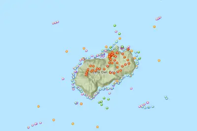
Research and Monitoring Sites
This layer indicates specific sites on Cocos Island that are used for scientific research and monitoring of ecosystems, biodiversity and environmental conditions
Geomorphology of Cocos Island
This layer identifies and classifies the different landforms of the island, including features such as mountains, valleys, plateaus and cliffs
REGIONAL GEODATA
.webp)
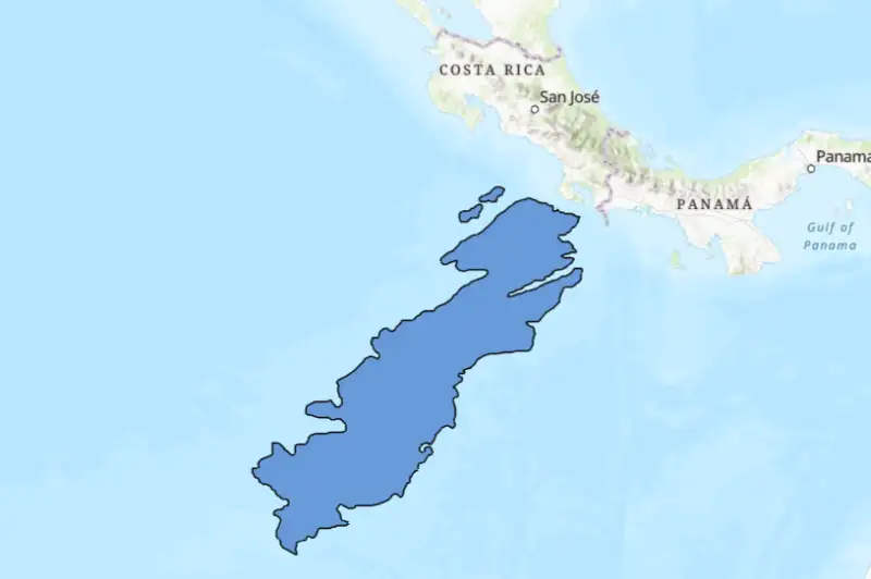
Costa Rica Exclusive Economic Zone (Polygon)
This layer shows the limits of Costa Rica's Pacific Exclusive Economic Zone (EEZ), delimited by a line that defines the country's maritime jurisdiction area
.webp)
Costa Rica Exclusive Economic Zone (Line)
This layer shows the limits of Costa Rica's Pacific Exclusive Economic Zone (EEZ), delimited by a line that defines the country's maritime jurisdiction area
Cocos Submarine Volcanic Ridge
The Cocos Submarine Volcanic Ridge is a chain of volcanic rocks that extends underwater in the Pacific, off the coast of Costa Rica. It is the largest submarine volcanic ridge in Central America
.webp)
Puntarenas - Cocos Island Route (Line)
This layer shows the route from Estero Puntarenas to Wafer Bay on Cocos Island, represented by a line connecting points
.webp)
Puntarenas - Cocos Island Route (Points)
This layer shows the route from Estero Puntarenas to Wafer Bay on Cocos Island, represented by a series of points