Geoviewers
Explore our interactive geographic viewers to better understand Cocos Island and its key sites.
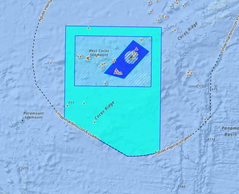
ACMC Protected Wildlife Areas 1978 - 2021
The Cocos Marine Conservation Area (ACMC) Protected Wilderness Historical Viewer provides an interactive overview of changes and expansions from 1978 to 2021. This geospatial tool allows users to explore the chronological evolution of protected area boundaries and categories, providing a visual perspective on how conservation has strengthened over time. Through detailed data layers and filtering options, users can observe key events such as the creation of Cocos Island National Park and subsequent expansions of these marine protected areas.
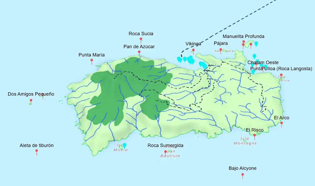
Geography of Cocos Island
The Cocos Island Geography 3D viewer shows the topography, trails, water supply system, and other key features of Cocos Island. This viewer allows for detailed exploration of the island's geography and ecosystems, highlighting key geographical features and facilitating the planning of sustainable tourism research and activities.
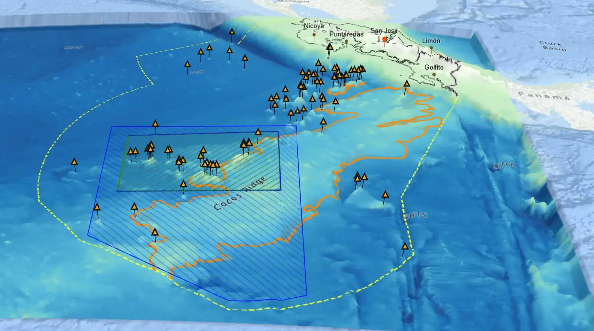
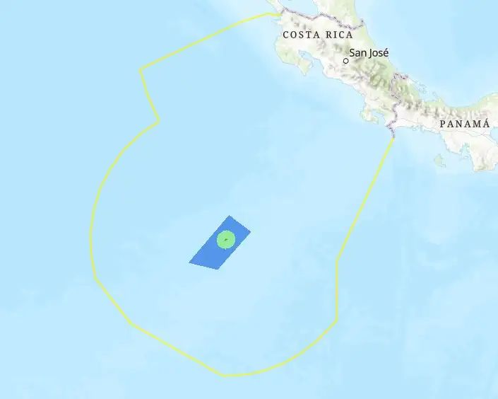
Three-dimensional relief of the Exclusive Economic Zone
This Geographic Viewer presents a detailed view of Costa Rica's seabed, including significant areas such as Cocos Island National Park and the Bicentennial Marine Management Area. The interactive interface allows users to explore structures such as seamounts and the Cocos Submarine Volcanic Range, highlighting their importance to marine biodiversity. This viewer is designed to be an effective educational tool, providing detailed and accessible information to support the understanding and conservation of Costa Rica's marine resources.
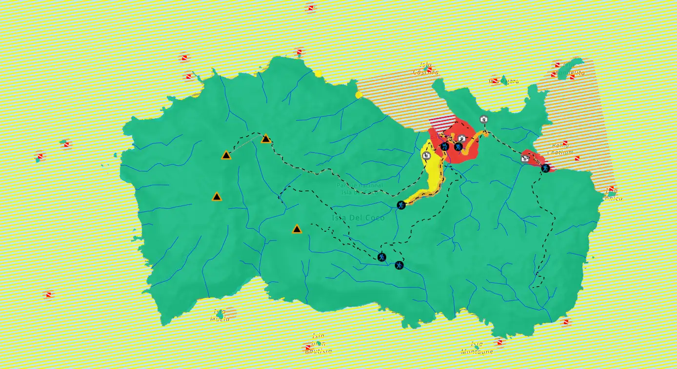
Cocos Island National Park
This geographic viewer presents the zoning proposal for Cocos Island National Park (CINP). Zoning in a protected wildlife area is a fundamental tool for managing the sustainable use of natural resources, dividing the space into different zones with objectives of conservation, public use, and controlled economic activities. This allows for the protection of sensitive ecosystems while promoting responsible economic activities, which are essential for biodiversity and for the users of these areas.
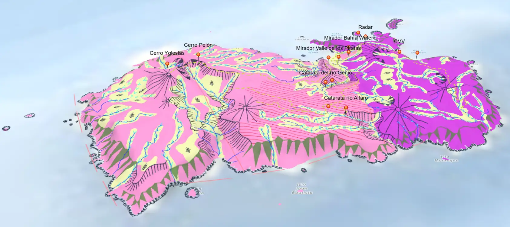
Geomorphology of Cocos Island
The geographic viewer describing the geomorphology of Cocos Island offers a detailed view of the island's geological and relief features. This viewer allows you to explore the topography and landforms, providing a deeper understanding of the geological processes that have shaped this island territory. Through this tool, users can visualize the various elevations, slopes, and key geological formations, making it a valuable tool for scientific studies, resource management, and conservation planning.
ACMC Protected Wild Areas (2011 Version)
This interactive viewer allows users to understand the configuration of ACMC ASPs as they existed in 2011. It is a useful tool for comparing the evolution of management and expansion of these areas, supporting historical studies, environmental planning, and decision-making in marine conservation.
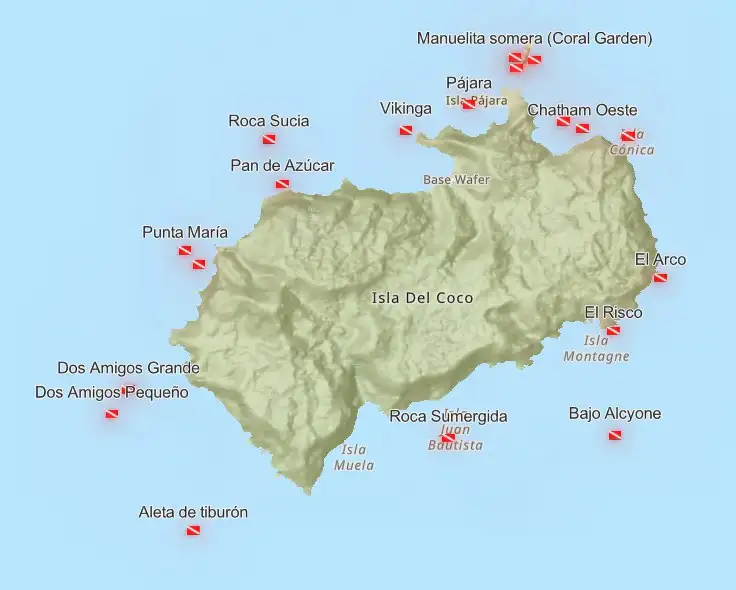
Acceptable Carrying Capacity for Diving Sites
This geographic viewer allows to visualize the distribution and acceptable visitor capacity for dive sites in Cocos Island National Park (CINP). Developed as a management tool for the administration of the protected area, the viewer integrates geospatial data on the location of dive sites, their environmental characteristics, and the maximum visitor capacity allowed at each site to minimize ecological impact.