Wave height
—m
Significant height · mean of the highest third
Real-time ocean data transmitted via satellite from a Sofar Spotter buoy moored off Cocos Island.
Last observation: — · Transmits every ~1 h
Significant height · mean of the highest third
Peak · Mean: — s
—
— m/s · —
Sea state: —
Surface node
In-line node
Underwater noise (SPL)
In-line node
Smart Mooring · −25 m
The Spotter buoy measures the surface and transmits by satellite. Below it hangs a ~25 m mooring with three Bristlemouth nodes that measure the water column down to the seabed.
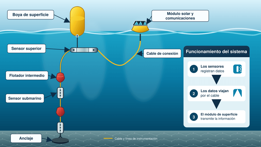
Source: Sofar Ocean Spotter · Cocos Buoy (SPOT-33020C) · Iridium satellite